
- Why Geography Still Matters in a GPS World: Mental Maps
- Why learn geography when we have GPS?
- How mental maps shape spatial thinking
- What spatial thinking looks like in school
- Why geographic literacy matters in the digital age
- How technology can build spatial thinking instead of replacing it
- What students, teachers, and parents can practice
Why Geography Still Matters in a GPS World: Mental Maps
A student can follow GPS directions to a friend’s house every week and still be unable to point toward downtown, name the neighboring town, or explain how the route connects to the rest of the city. That gap gets at why geography still matters in a GPS world.
GPS can tell someone where to turn next. Geography helps explain how places fit together, why a route takes a particular shape, and what might change when one location, road, or resource changes. For students, parents, and teachers, the distinction is practical: digital maps can support learning, but they do not automatically build geographic knowledge.
A study of GPS and non-GPS navigation found that GPS users recognized fewer paths and identified fewer landmarks than participants who navigated without technological assistance. National geography results also show room for improvement among some U.S. students. The answer is not to abandon navigation apps. It is to make room for the deeper skills geography develops: mental maps, spatial reasoning, pattern recognition, and the ability to interpret relationships between places.
Why learn geography when we have GPS?
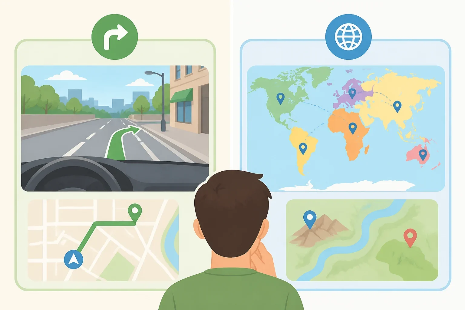
Navigation and geographic understanding overlap, but they are not the same task.
Navigation answers a narrow question: “What should happen next?” A phone might direct a driver to turn left, continue for a certain distance, and then take an exit. Geography asks broader questions: “Where am I relative to other places?” “What landmarks organize this area?” “How are these roads, neighborhoods, rivers, or boundaries connected?”
A study published last year examined spatial knowledge among 36 participants in Madinaty City, Egypt. Each participant followed seven paths to five destinations, using either GPS or non-GPS directions. The GPS group showed lower path recognition and weaker landmark identification than the group that navigated without technological assistance (a study of GPS and non-GPS navigation).
The researchers suggested that GPS reliance may limit spatial and landmark learning because users focus on the prescribed route instead of observing features around them. That does not mean using GPS is harmful, or that every person who uses a navigation app will lose geographic awareness. The study involved a small group in one planned city. It identifies a pattern worth examining, not a universal rule.
The useful distinction is simple:
- Turn-by-turn navigation helps a person reach a destination.
- Geographic knowledge helps a person understand the destination, the route, and the surrounding area.
- Spatial thinking helps a person reason about how locations relate to one another.
Geography class is not only about memorizing capitals or labeling a blank map. Depending on the grade, teacher, and curriculum, it may involve comparing locations, interpreting maps, recognizing patterns, and explaining how conditions in one place relate to conditions somewhere else.
How mental maps shape spatial thinking
A mental map is a person’s internal, changing picture of how places relate to one another. It is not a perfectly scaled map stored in the brain. Think of it as a working sketch that helps someone decide whether a place is nearby, which route seems familiar, or how one region compares with another.
Geographers describe mental maps as evolving summaries of spatial knowledge. They can indicate how well people understand the characteristics and relationships of places, according to National Geographic Education, which published its current resource three months ago.
Mental maps are usually more realistic for places close to home than for places known only through brief visits, descriptions, or media. That observation suggests why firsthand experience can matter, without proving that repeated experience always produces better spatial knowledge. A student who regularly walks through a neighborhood may remember its landmarks and turns differently from someone who sees the same area only as a line on a phone screen.
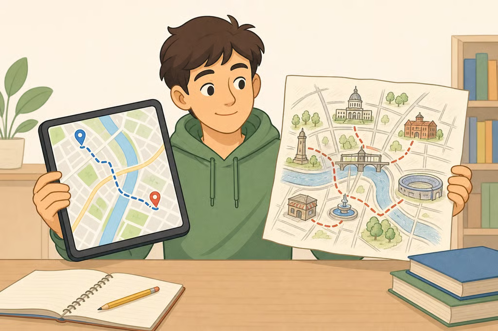
A short classroom activity makes the idea visible. Ask students to sketch the route from school to a familiar place without opening a map. The sketch does not need to look artistic. It should show the landmarks, turns, directions, approximate distances, and nearby places the student considers important.
Then have students compare the sketch with a digital map. The goal is not to mark every mistake. Instead, ask:
- Which landmarks appeared in the sketch?
- Which roads or places were left out?
- Did the student make the route longer, shorter, or more direct than it is?
- Which parts were remembered as connected?
- Did different students draw the same area in different ways?
The activity turns an invisible process into something students can inspect. A mental map reflects experience, attention, and perception. It may also reveal what a person notices and what they overlook.
This kind of thinking connects to more than personal travel. National Geographic Education explains that studying how people perceive regions can help experts understand patterns involving land use, migration, tourism, and other engagement with places. For students, that means a map is not merely a picture of where things are. It can also support questions about how people use, value, and move through places.
What spatial thinking looks like in school
Spatial thinking can sound abstract until it is attached to an observable task. A 2006 National Research Council report helped establish spatial thinking as an important educational competency. A study published nine months ago describes three components: understanding concepts of space, using tools of representation, and reasoning through spatial problems (the GIS and STEM study).
In practice, students might demonstrate spatial thinking when they:
- recognize a pattern in where places or resources are located
- compare the position of two locations
- interpret distance, direction, or scale
- use a map, image, or other representation to organize information
- identify relationships between physical and human features
- reason about how a change in one place could affect another
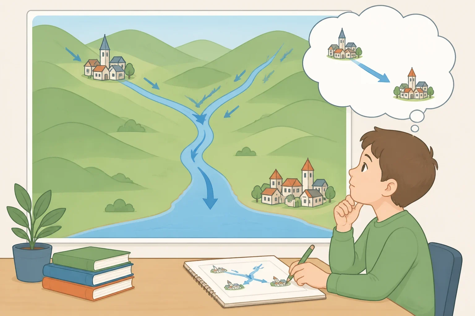
Consider a simple comparison. A student may know that two towns are both near a river. A student using stronger spatial reasoning might also compare which town is upstream, how roads connect them, whether the towns have similar access to transportation, or how a change in the river could affect each location differently. The task is not just to locate features. It is to explain relationships.
Those skills apply across subjects. A science lesson may ask students to interpret a watershed. A history lesson may examine how location shaped movement or settlement. A civics lesson may compare access to services in different areas. A math lesson may involve scale, distance, or coordinate systems. The exact assignment depends on the curriculum, but the underlying habit is similar: use location and spatial relationships as evidence.
Why geographic literacy matters in the digital age
Geographic literacy means having enough geographic knowledge and spatial reasoning to interpret places, maps, and relationships rather than simply identify a destination. It does not require every student to memorize every place name. It does require practice with the kinds of questions a navigation app usually answers for the user.
The National Assessment of Educational Progress, or NAEP, provides a broad view of what U.S. students know and can do in geography. The assessment is administered in grades 4, 8, and 12, according to the current NCES geography page, updated five months ago.
The most recent geography assessment listed by NCES was given in 2018 to approximately 12,900 eighth-grade students. Average geography scores were lower in 2018 than in 2014, and the decrease was concentrated among lower-performing students, while scores for middle- and higher-performing students remained stable (NCES reports).
That information should be read carefully. The NCES page identifies 2018 as the most recent geography assessment, so it does not provide a current measure of every student’s geographic knowledge. It also does not show that GPS use caused the score changes. The results point to an educational need, not a cause-and-effect conclusion.
For teachers, the data supports attention to mixed levels of preparation. For parents, it offers a reason to ask what students do with maps in class, not simply whether a classroom uses mapping technology. For students, it reinforces a useful idea: being able to locate a place is one step, while explaining its relationships to other places is a more demanding skill.
How technology can build spatial thinking instead of replacing it
The issue is not whether a map appears on a screen. The better question is what the learner has to do with it.
A digital map used as a shortcut can reduce a task to following instructions. A digital map used as evidence can prompt investigation, comparison, and explanation. The same device can support either habit.
A study published nine months ago examined 136 senior high school students through a quasi-experimental 2-by-2 factorial design. Students used GIS, or a Geographic Information System, as part of the study’s learning conditions. After researchers controlled for students’ pretest scores, the GIS effect on posttest spatial-thinking scores was statistically significant, with F(1,131) = 250.715, p < .001, and partial eta-squared, η²p, = .657 (the study reports these results).
Partial eta-squared is an effect-size statistic used in this study. It describes the size of the observed effect under the study’s design and controls. It should not be treated as a universal percentage for every classroom or as proof that GIS explains the same share of spatial ability in a broader population.
The study also reported a statistically significant interaction between GIS and a STEM-based instructional approach, with F(1,131) = 19.314, p < .001, and η²p = .128 (the GIS and STEM findings). In plain language, the combination produced a stronger result in that study than either approach considered separately. That is promising, but one quasi-experimental study does not establish a guaranteed outcome for every school.
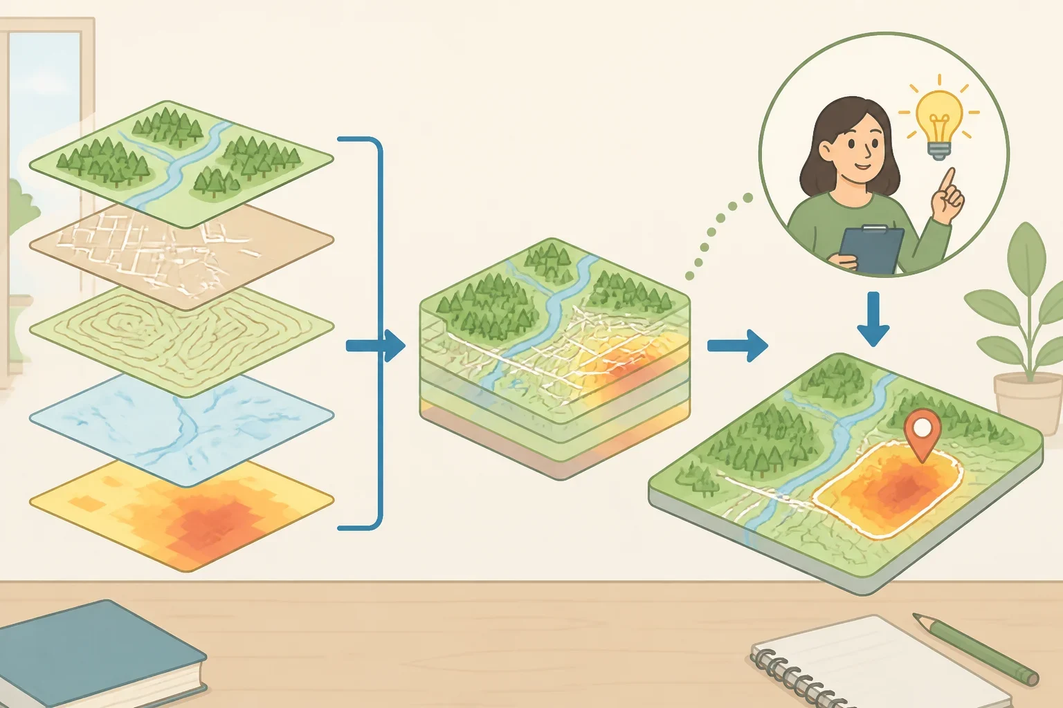
An inquiry-based activity might ask students to use GIS to compare locations and answer a question such as:
- Which areas have greater access to public transportation?
- How do roads, elevation, or water features relate to a problem shown on the map?
- What patterns appear when two layers of geographic information are viewed together?
- What evidence supports an explanation about why a feature is located where it is?
The student should not merely point to the answer on the screen. The student should describe the pattern, compare locations, identify evidence, and explain the reasoning.
A separate study published 11 months ago examined Google Earth within Spatial Problem-Based Learning. It used a quasi-experimental comparison between a group receiving Google Earth-assisted instruction and a group receiving conventional direct instruction. Students completed spatial-thinking tests before and after instruction, and the researchers used a Mann-Whitney U test to compare the groups. The experimental group showed statistically significant improvement compared with the control group (the Google Earth study reports the comparison).
The practical lesson is not “replace teaching with Google Earth.” It is to give students a question that requires them to inspect, compare, and reason. Technology becomes a tool for geographic literacy when students have to make sense of information, not just receive directions.
What students, teachers, and parents can practice
Students can build spatial awareness without giving up GPS. Before checking a route, sketch it from memory. Mark a few landmarks, estimate direction and distance, and describe how the destination relates to nearby places. Then compare the sketch with a digital map and revise it.
Teachers can ask for explanations that turn navigation into geography:
- “Describe the route without giving turn-by-turn instructions.”
- “Which of these two locations is closer to the river, and what evidence shows that?”
- “What pattern do you see when these map layers are compared?”
- “If one feature changed, which nearby places might be affected, and why?”
Parents can ask a more useful question than “Does the class use an app?” Ask what students do with maps. Do they compare locations, interpret patterns, sketch routes, examine different perspectives, or use digital tools to investigate a question? Requirements and activities vary by teacher, school, district, and state, so the school’s social studies framework or curriculum office is the right place to check local expectations.
GPS is excellent at supplying immediate directions. Geography adds the ability to understand the setting, question the information, and reason about connections that turn-by-turn instructions leave unexplained. A good next step is small: sketch one familiar route this week, compare it with a map, and write down one relationship between places that the directions alone did not reveal.