


The United States is usually split into at least seven regions (Northwest, West, Southwest, Midwest, South, Northeast, Alaska and Hawaii). Further distinctions are often made for additional regional categorizations, such as mid-Atlantic, New England and Great Lakes. It's hard enough to learn the names of each region and the states within each region, let alone what characteristics distinguish each region. To help kids understand each region's identity better, focus on activities about the topics that matter most to kids, such as regional cuisine, professional sports teams, music and typical animals/plants.
Cuisine Activities
One way to understand the regions of the United States is to look at how local cuisines differ. For instance, many areas of the South are known for barbecue, the Pacific Northwest has tons of freshly caught seafood, and Southwestern cuisine features dishes like fajitas and tamales. To help instill each region's identity, give the class one or two typical dishes you may find in each American region (e.g., clam chowder in New England or shrimp in the Gulf Coast). If kids have a visual picture of a food that looks tasty, they may have an easier time remembering the many U.S. regions.
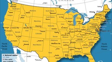
For a more ambitious project, split the class into groups and assign each group a region. Give each group a week to research the region's cuisine and to prepare a regional dish to share with the class. Or bring in sample cuisines from different regions. If kids literally taste the different flavors they will have a sensory link to each region. To further instill this link, continuously refer back to a U.S. map as you break down regional cuisines.
Music and Culture
As you teach each region of the United States, highlight local music that came out of the region, regional artistic movements and professional sports teams. For instance, as you teach the West Coast region, play the class music that hailed from Los Angeles such as the Beach Boys or show a clip from a movie filmed in that region. Once you define each region by its music, art, film and literature, play an identification game with your students. Break your class into two teams. Then play a selection of songs, read book excerpts, show pictures of local art and show the film clips and have the class identify the correlating region on a map with push pins or labels. As your kids begin to make the aural and visual associations with the regions, the differences will begin to set in.
Play a similar game for professional or college sports teams. Use crayons that correspond to team colors and have kids draw a map of the United States that notates all the different sports teams using team colors. Once the map is filled out, use a permanent marker to outline each region. As many kids enjoy sports, the sports/region link will help solidify location in their minds.
Animals and Plants
Many kids like either animals, flowers/plants/trees or both. To help highlight regional differences, go through the native and introduced flora and fauna of each region (e.g., cacti in the Southwest, bison in parts of the West and Midwest). Come up with a list of a couple regional plants and regional animals from all the major United States areas. Attach pictures of each to a large U.S. map. To help your students remember, have the class create construction paper cutouts of plants and animals. On the back of each cutout, have the kids write down the region from which the plant/animals hails. In addition, your students can write a list of regional sights or interests, people born in the region or demographic facts on the back of the cutout. Put each cutout on the class map so kids see their work and the work of their friends for weeks to come. Encourage kids to look at the back of each animal/plant cutout for more specific regional information.
Related Articles


References
- Close-Up USA; Gilber M. Grosvenor, ed; 1978
- National Geographic Guide to the National Parks; Carolin Hickey, Project Manager; 2003
Writer Bio
Alexander Grouch is a freelance screenwriter, journalist and children's book author. He currently writes music reviews for "The Red Alert." Grouch has visited all 48 contiguous states and plans to document his journeys in a travelogue. He earned a Bachelor of Arts in Africana studies from Brown University.